Test Centers | Laboratories

Fraunhofer IEE Wind Measuring Network

Research and testing platform 200-metre high measurement mast

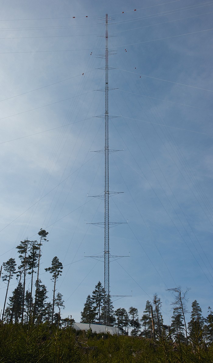
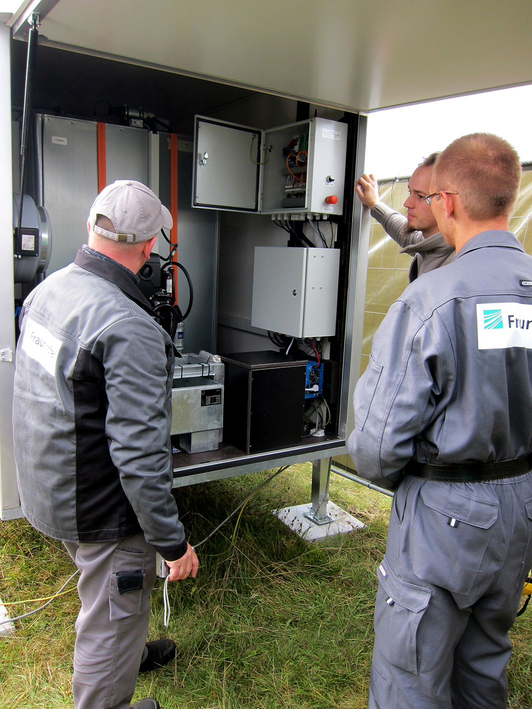
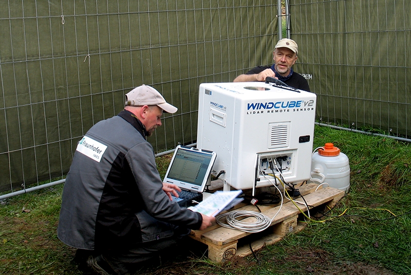
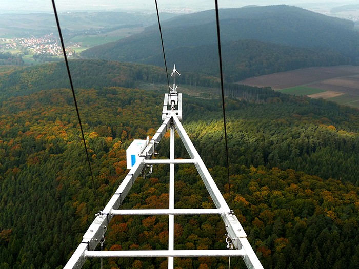
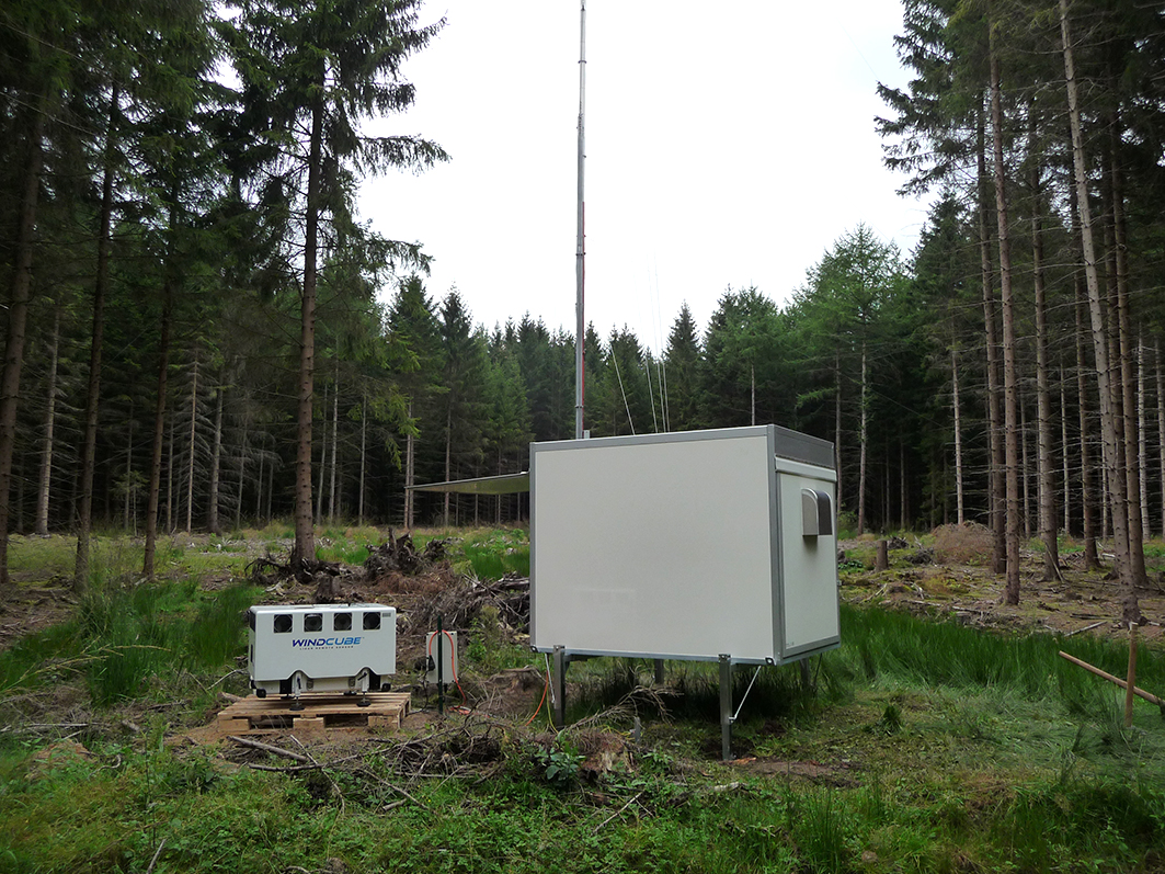
Our 200-metre high research measurement mast on the Rödeser Berg near Kassel is the only facility of its kind in Germany. We use the mast to investigate the wind profile and the wind characteristics up to very great heights. In addition, our "vertical laboratory" allows us to fit sensors and measurement systems directly to the mast at heights of up to 200 metres above ground level and test them. Moreover, comparative measurements and validation tests for remote measuring systems can be carried out under complex wind flow conditions. So far, a whole variety of different testing and measurement projects have been carried out using the 200m mast, including using LiDAR and SoDAR wind measurement devices, LiDAR wind scanners, and ice and bat sensors.

The 200m mast is situated on a hilltop in a typical wooded, upland location, and it has the following specification:

  • Wind measurement mast with a measurement height of 200 m
  • A wide range of equipment: over 20 wind sensors distributed at 13 different measuring heights, and 40 meteorological sensors in total, including several ultrasound anemometers and a ceilometer
  • High-precision measurement system: IEC-compliant, MEASNET-calibrated wind measurement sensors
© Fraunhofer IEE

200-metre high measurement mast

200-metre high measurement mast Wolfhagen - Fraunhofer IEE

LiDAR wind measurements – Device Portfolio

© Fraunhofer IEE
© Fraunhofer IEE

The laser-assisted LiDAR (Light Detection And Ranging) technology provides an attractive alternative to conventional mast-based wind measurement. The compact, transportable devices can be quickly and flexibly positioned on the ground, and they make it possible to take wind measurements up to and beyond the hub height of modern wind turbines. In September 2014, the Fördergesellschaft Windenergie und andere Erneuerbare Energien e.V. [Wind Power and other Renewable Energies Federation] (FGW) decided to issue the 9th revision of its Technical Guideline Part 6 "Determination of the Wind Potential and Energy Yields". It includes provisions which allow wind reports to be drawn up based on measurements of wind potential that are produced only from LiDAR measurements.

We operate several mobile LiDAR wind measurement devices. These have already been successfully used throughout Germany for scientific measurement projects and for contract measurements, including for the production of yield reports. The LiDAR systems provide the following options:

  • Measurement at a choice of up to ten different measuring heights between 40 m and 200 m,
    including at sites with complex wind flow conditions, such as in wooded, hilly terrain
  • Gathering of the 10-minute mean values for wind speed and direction at all
    the chosen measurement heights
  • Measurement in remote locations via remote monitoring and using stand-alone electricity supplies

The LiDAR devices are regularly serviced by the manufacturers and are used by us in accordance with the latest scientific and technical standards. We also regularly have verification tests carried out according to draft IEC standard 61400-12-1 Ed2 CD by an accredited measurement institute. This allows the LiDAR wind measurements to be evaluated and reproduced with a specified level of certainty.

LiDAR wind measurements – Optimised Planning

© Fraunhofer IEE

The choice of the measurement location has a decisive influence on the measurement result and the evaluation of measurement uncertainty. We have therefore developed a new method which enables us to identify the ideal LiDAR measurement location in advance. This not only reduces measurement uncertainty, it also saves a lot of time and planning workload.

This involves the production of a high-resolution map for the planning area based on a wind flow simulation and calculated correction factors. The visual representation of the LiDAR measurement errors then allows particularly favourable locations to be easily distinguished from less favourable ones. The errors map can also be easily incorporated as a GIS layer into planning tools such as WindPro. This also allows further criteria relating to the measurement location to be taken into account without major financial outlay, e.g. the planned siting of the wind turbines and existing means of access and clearings. The result is that one or more ideal measurement sites are easily identified.

The procedure is based on the determining and applying of "correction factors" for the various wind directions at a specific location. The advantage of this is that the anticipated measurement errors in the area of the planned wind farm are determined in advance. This allows the LiDAR measurements to be planned based on the use of an optimal location for reducing the level of uncertainty in the wind report.

Fraunhofer IEE provides the innovative LiDAR errors map service based on its own calculation procedures.

LiDAR wind measurements – In Complex Terrain

© Fraunhofer IEE
© Fraunhofer IEE

The expansion of inland wind energy often takes place – particularly in central and southern Germany – in wooded locations with "complex" topographic relief (height structures). Exposed high-altitude sites generally offer good wind conditions. The continual development of woodland sites is a consequence of this.

Depending on the measurement principle used however, additional challenges arise for LiDAR wind measurements in so-called "complex" terrain. So far we have used our LiDAR systems on our 200-metre wind measurement mast near Kassel as well as at various of our project partners' locations. This has given us a wealth of experience in relation to accuracy, but also in relation to systemic measurement errors. This is because it is precisely in these areas, i.e. in upland areas and on hilltops and in woodland, that the measurements are occasionally subject to errors due to the measurement principle used.

We have conducted in-depth investigations into the applicability of LiDAR wind measurements in complex terrain, including in connection with the BMWi-sponsored project "Windenergienutzung im Binnenland" (Inland use of wind energy). The measurement results obtained from a comparative measurement exercise involving the 200-metre wind measurement mast and various LiDAR measurement devices show that it also makes sense to use the devices in such locations.

"The measurement errors are less than initially expected and can be fairly accurately estimated using CFD (computational fluid dynamics) simulations. We can therefore definitely recommend the use of LiDAR wind measurements, even at typical inland locations such as wooded upland areas", says Tobias Klaas, project manager at Fraunhofer IEE. This means that the targeted use of LiDAR wind measurement systems to determine wind potential is possible even in complex terrain.

LiDAR wind measurements – for producing wind potential and yield reports

© Fraunhofer IEE

In September 2014 the Fördergesellschaft Windenergie und andere Erneuerbare Energien e.V. [Wind Power and other Renewable Energies Federation] (FGW) decided to issue the 9th revision of its Technical Guideline Part 6 "Determination of the Wind Potential and Energy Yields". This permits measurements of wind potential for drawing up wind reports to be carried out based solely on LiDAR measurements. Fraunhofer IEE operates a portfolio of LiDAR devices which is used for research and contract measurements throughout Germany.

Spend two minutes with Doron Callies, scientist at Fraunhofer IEE and a part of the IRPWind Mobility Programme.

In this video he talks about the Mobility Programme as well as his experience working with Windscanner and NEWA.